 |
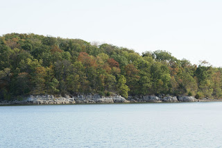
| One of the many bays on Kentucky Lake |
 |
| Land Between The Lakes |
October 17
We traveled through Kentucky Lake Kentucky Lake Tennessee River . It was formed in 1944 when the Kentucky Barkley Lake
 |
| Abandoned dock was an important shipping point prior to Kentucky Dam being built |
We didn’t plan to go this far, but when we tried to
pull into Little Crooked Creek to anchor for the night, the water was too
shallow. Plan B – Go to Pebble Isle Marina
October 18,
 |
| The long path into Pebble Isle: Notice sand bar in front of us and marina buildings WAY in the back. |
Brian ranked Pebble Isle near the top of his favorite marinas. One of the employees serves fresh from the oven homemade hot cinnamon rolls for the boaters every morning at 8:30 sharp. He's ready to stay here for a week! But, instead we travel back the winding path to the river. Another 14 miles on Kentucky Lake and then the water narrows to simply the Tennessee River.
Mussel harvesting is a million dollar industry in this area. These strange looking boats have lines and prongs dangling from their flat roofs. As a mussel opens its shell slightly to get food, the prong enters, the mussel clamps down on it thinking it has a yummy morsel. Caught!!! The meat is used for fish bait. Most of the shells are exported toJapan
*****Every once in a while I feel like I need to insert a little worthwhile information. I’ve read other blogs that are crammed full of history and interesting tidbits. I prefer to make my readers really search through the drivel to find the good stuff. Think of it as a wordy ‘Where’s Waldo?’.******
 |
| Harvesting mussels |
Mussel harvesting is a million dollar industry in this area. These strange looking boats have lines and prongs dangling from their flat roofs. As a mussel opens its shell slightly to get food, the prong enters, the mussel clamps down on it thinking it has a yummy morsel. Caught!!! The meat is used for fish bait. Most of the shells are exported to
*****Every once in a while I feel like I need to insert a little worthwhile information. I’ve read other blogs that are crammed full of history and interesting tidbits. I prefer to make my readers really search through the drivel to find the good stuff. Think of it as a wordy ‘Where’s Waldo?’.******
 |
| Someone is way too crazy about lighthouses. Six story house under construction. |
We came across another intricate dredging project. This one brings sand and gravel up from the river bottom. The water is drained off, and the gravel and sand are sorted and placed in separate barges for delivery.
 |
Water extracted off center front. Sand deposited in two barges at back and gravel in barge in front two barges at back and gravel in barge in front |
The anchorage for tonight is behind a small island. Cozy and quiet….
October 19
Erosion on the rivers is a huge problem especially
with annual and even semi-annual floods.
There is too much frontage for the Corps of Engineers to rip rap and it
doesn’t appear that land owners are required to do it. Over time the river carves a new route due to
erosion and shoaling. We encounter one
curve after another that would be about two miles straight line, but is closer
to nine miles following the river.
 |
| Mother Nature's rip rap |
 |
| Our navigation screen showing one of the curves in the river. |
 |
| The only bank we've seen with planted erosion control |
 |
| The Shiloh National Military Park |
This is one of the most historically significant areas on the Tennessee River . Grant was having breakfast at the Cherry Mansion April 6, 1862 when he heard distant artillery fire. The Confederate army was attacking in nearby Shiloh . During the two day battle, 23,000 men were killed in locations now named Bloody Pond, Hell’s Hollow and the Hornet’s Nest. The Shiloh National Military Park
For tonight we’re in a familiar marina – Aqua Harbor Iuka , Mississippi
We're met on the dock by Bill who helps us with our lines for the second time on this trip. We met him and his wife, Deb, in Green Turtle. They invite us to join them for dinner along with the owner of a Florida Bay Coaster. Florida Bay Coasters are a very interesting boat...only 14 have been built. We had considered buying one about 18 years ago. For our 25th wedding anniversary we chartered one for a week with our good friends Larry and Joan Arnold.
Gotta smile -- we're lovin the ride!


That mussel boat reminds me of something I built with my Erector set when I was much younger.
ReplyDeleteLove the drivel...I am even learning things about places I have passed for many years, but never took the time to ask.... Pebble Isle...one of my favorites as well...the best catfish on the river! And the fog...memories! None in marinas....it waits for you in the middle of the river, usually when a tow boat is coming at 'cha! Keep smilin'...two days and Life Will Be Swell On Veda L!
ReplyDelete